Did not you find what you were looking for? Ask us! We have archives of 140 TB. We have all modern reuse projects and renovation projects for Soviet standard buildings. Write to us: info@proekt.sx
dam project


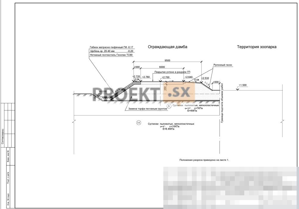


Artificial structures for the formation of the territory and protection from natural phenomena. Dam project.
Technical and economic characteristics of the capital construction object
Territory area (plot 1), ha: 8,74
Territory area (plot 2), ha: 75,10
Territory area within the design boundaries, ha: 51,46
Dam length, m: 3143
The dam has a trapezoidal profile with a top width of 9.5 m.
Capital class of a hydraulic structure (dam) - III
The total length of the dam along the axis is ~3143 m.
The mark on the ridge is 2.700 in the BS.
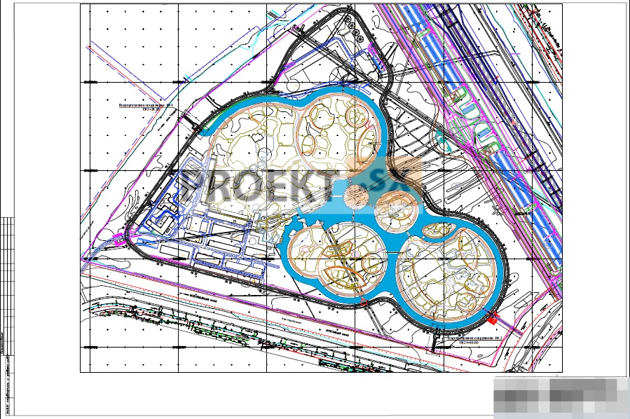
2. Reservoirs:
Mark of the maximum design water level -0.600 m BS
Elevation of the bottom of reservoirs - minus 1.50 m BS
The width along the bottom of the channels along the dam is 7,5 m.
Water surface area of reservoirs -56800 m2
Total length - 3057 m 2. Islands:
The area of the islands is 514608 sq. m
Substantiation of the possibility of carrying out the construction of a capital construction object by stages of construction with the allocation of these stages
Design documentation for the construction of the dam was developed on the basis of the master plan, updated and adapted. The basic principle of the formation of the territory is the island location of the continents, taking into account the zoogeographic distribution of animals. Taking into account the complex engineering-geological, hydrogeological and hydrological conditions, namely: widespread distribution of peat; widespread distribution of weak soils; difficult conditions for surface runoff; high level of standing groundwater, development of the territory as part of engineering training should be carried out in the following sequence: ITP stage - erection of a protecting dam, arrangement of channels, bank protection of channels, backfilling of islands up to a mark of + 1.5 m, bank protection of islands, construction of culverts; Stage II of ITP - backfilling of islands to planning marks, construction of roads, bridges, flyovers, construction of engineering structures and networks. The project documentation has been developed in accordance with the town planning plan of the land plot, the design task, the town planning regulations, documents on the use of the land plot for construction (if the land plot is not covered by the town planning regulations or the town planning regulations are not established in relation to it), technical regulations, including those establishing requirements for ensuring the safety of operation of buildings, structures, structures and the safe use of territories adjacent to them, and in compliance with technical specifications.